Skip to content
Home » Blogs » Unveiling the Power of GIS in Modern Surveying Practices

Unveiling the Power of GIS in Modern Surveying Practices

Unveiling the Power of GIS in Modern Surveying Practices

In the ever-evolving landscape of technological advancements, the seamless integration of Geographic Information Systems (GIS) and surveying has emerged as a pivotal force, reshaping the contours of precision and efficiency in land-related endeavors. At MachOne Industries, where cutting-edge drone services meet top-notch surveying solutions, the marriage of GIS and surveying is not just a collaboration—it’s a revolution.

Three construction workers in safety vests and helmets, reviewing plans on a tablet near a construction site

Exploring the Essence of GIS and Surveying

In the realm of contemporary land management, the term “GIS and surveying” is more than a mere buzzword—it’s a paradigm shift. GIS, a technology that captures, analyzes, and interprets spatial data, finds its sweet spot when coupled with the meticulous art of surveying. Together, they form a dynamic duo, creating a synergy that transcends traditional boundaries.

GIS and Surveying: A Symbiotic Relationship

Understanding the Relationship between GIS and Surveying

At the core of our exploration lies the intricate relationship between GIS and surveying. GIS acts as the digital backbone, providing a spatial context to survey data. It transforms raw surveying data into a comprehensive visual representation, allowing for better analysis and decision-making. Imagine a map that not only marks the coordinates but tells the story of the terrain it covers.

A drone equipped with GIS technology surveys a vast green landscape, projecting a holographic grid that segments and analyzes the terrain

The Role of GIS in Land Surveying

Unveiling the Applications of GIS in Land Surveying

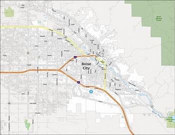
As pioneers in drone services, MachOne Industries harnesses the power of GIS to redefine the art of land surveying. From property delineation to environmental monitoring, GIS seamlessly integrates with surveying techniques, elevating the precision and scope of our operations. The application of GIS in land surveying is not a luxury—it’s a necessity for those who strive for unparalleled accuracy.

GIS Survey: Navigating Precision with Technology

Mastering the Art of GIS Survey

For those unfamiliar with GIS surveys, envision a process where drones equipped with cutting-edge GIS technology capture high-resolution imagery, translating it into invaluable data for surveying purposes. It’s not just about collecting information; it’s about unlocking a new dimension of precision that traditional methods struggle to achieve.

Bringing GIS and Surveying Together: A Practical Approach

Practical Tips for Harnessing the Power of GIS in Surveying

Data Integration: Seamlessly integrate GIS and surveying data to create a comprehensive dataset that tells a compelling story.

Real-Time Analysis: Leverage GIS capabilities for real-time analysis during surveys, enhancing decision-making in the field.

Enhanced Visualization: Utilize GIS mapping to provide stakeholders with a clear and visually appealing understanding of surveyed areas.

Conclusion: A Future Defined by GIS and Surveying

In conclusion, the relationship between GIS and surveying is not a mere collaboration—it’s a necessity for those aiming to redefine precision in land-related ventures. At MachOne Industries, where innovation meets expertise, we continue to push the boundaries of what GIS and surveying can achieve together. Embrace the future of land management with the dynamic duo that is transforming the way we perceive and interact with our surroundings.

A detailed GIS and drone technology map of Boise City showcasing the city layout, major roads, and surrounding green areas
Summary
Unveiling the Power of GIS in Modern Surveying Practices
Article Name
Unveiling the Power of GIS in Modern Surveying Practices
Description
Unveiling the Power of GIS in Modern Surveying Practices
Author
Publisher Name
MachOne Industries
Publisher Logo

2 thoughts on “Unveiling the Power of GIS in Modern Surveying Practices”

Leave a Reply

Your email address will not be published. Required fields are marked *