Skip to content
Home » Blogs » Drones in Land Survey

Drones in Land Survey

Unveiling the Power of GIS in Modern Surveying Practices

Unlocking the Skies: How Drones are Revolutionizing Land Surveying

Introduction:
Hey there, fellow explorers of the digital frontier! Today, let’s dive into an exciting topic that’s reshaping the world of land surveying – the incredible synergy of drones and surveying. As your friendly guide in the vast landscape of technology and innovation, I’m thrilled to share the wonders of “Drones in Land Survey.

The Magic of Precision in Land Surveying

In our quest for precision in land surveying, imagine having a high-tech assistant that can fly above, capturing details with jaw-dropping accuracy. That’s the magic of drones surveying, changing the game, and making traditional methods look like ancient history. Picture this: drones equipped with state-of-the-art sensors, buzzing above, and providing a bird’s-eye view that even our ancestors would envy. It’s not just about surveying; it’s about creating a digital masterpiece of the terrain, giving us a deeper understanding and a smarter decision-making abilities. Drones, with their incredible precision, can survey vast landscapes in a fraction of the time it would take traditional methods. The intricate details captured by these flying marvels provide a wealth of data, creating a canvas of information for land surveyors to analyze and interpret. In the realm of precision, drones have become the unsung heroes, revealing a level of accuracy that was once thought to be impossible. Whether it’s mapping out urban areas or examining the topography of remote terrains, drone surveying is revolutionizing the way we perceive and interact with our surroundings.

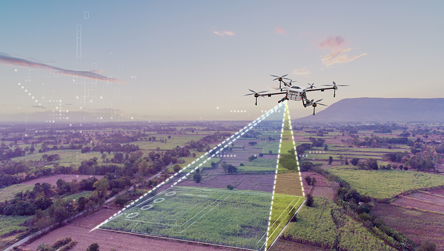
Aerial view of drones conducting a land survey, showcasing modern technology for precise mapping and data collection. #Drones #LandSurvey

Digital Land Surveying & Mapping – The Coolest Team-Up Yet

In a world where everything is going digital, our trusty land surveyors have teamed up with drones to create something extraordinary – digital land surveying & mapping. It’s not just a collaboration; it’s a revolution, bringing efficiency and precision to uncharted territories. Let’s get geeky for a moment. Drones are not just flying cameras; they’re the superheroes of real-time data collection, crafting high-res maps and 3D wonders. The fusion of Geographic Information System (GIS) with drone surveying? It’s like having a GPS for the future, guiding land surveyors to make informed decisions on the go. Digital land surveying & mapping have opened up new possibilities for understanding our environment. Drones equipped with advanced sensors can collect data that goes beyond traditional surveying methods. This digital partnership ensures that land surveyors have a comprehensive and accurate depiction of the landscape, empowering them to make data-driven decisions.

 Meet the Modern Land Surveyor – A Hero in the Drone Saga

Ever wondered who’s behind the scenes making sure drone surveys are as accurate as a GPS pin? It’s our trusty land surveyors, the unsung heroes of this technological dance. Let’s shine a spotlight on the land surveyors, blending their expertise with the finesse of drone technology. It’s not just about flying gadgets; it’s about human intelligence interpreting data, ensuring accuracy, and making crucial decisions that shape the surveying landscape. The modern land surveyor is not just a traditionalist; they are tech-savvy individuals who have embraced the marriage of human intuition and drone- ssisted efficiency. Their role involves not just operating drones but deciphering the data they provide, adding that crucial human touch to the technological symphony.

Land surveyors using a drone and traditional equipment in an open field, highlighting the integration of technology in land surveying.

The Future Takes Flight: Trends in Drone Surveying

As we soar through the present, it’s essential to glimpse into the future of drone surveying. New
technologies are emerging, promising even more efficiency and accuracy in land surveying. Artificial intelligence (AI) integration, enhanced sensor capabilities, and increased automation are paving the way for a new era in the field. The use of machine learning algorithms allows drones to not only collect data but also analyze it on the spot, providing real-time insights to land surveyors. This dynamic interaction between technology and human expertise is propelling the industry forward, unlocking possibilities we never thought possible. 

Diving Deeper:
Explore the potential applications of drone surveying in environmental conservation, disaster response, and urban planning. These versatile flying machines are not just limited to traditional surveying; they are becoming invaluable tools in addressing global challenges. 

A drone with advanced sensors hovers above a modern city, surrounded by holographic data visualizations, illustrating the integration of drones in land surveying.

Conclusion:
As we wrap up our journey through the skies and terrains, it’s clear that drones have become the trusty sidekicks in the land surveying saga. In this fusion of tech and human know-how, the future looks promising, with precision and efficiency leading the way.

Ready to explore more about the fascinating world of land surveying and drones? Dive into discussions, stay updated, and be part of the conversation by subscribing to our newsletter. The future of land surveying awaits your curiosity!

Summary
Drones in Land Survey
Article Name
Drones in Land Survey
Description
In the dynamic world of land surveying, a new era has dawned with the ascent of drones. Unmanned and agile, these aerial marvels are reshaping the traditional landscape of surveying, offering unparalleled precision and efficiency. Join us on a brief exploration as we unravel the transformative role of drones in revolutionizing the way we map and understand our terrain. Welcome to the future of land surveying—where the sky is no longer the limit!
Author
Publisher Name
MachOne Industries
Publisher Logo

1 thought on “Drones in Land Survey”

Leave a Reply

Your email address will not be published. Required fields are marked *